jmp
Cast Iron
- Joined
- Nov 8, 2001
- Location
- Mechanicsville, Va
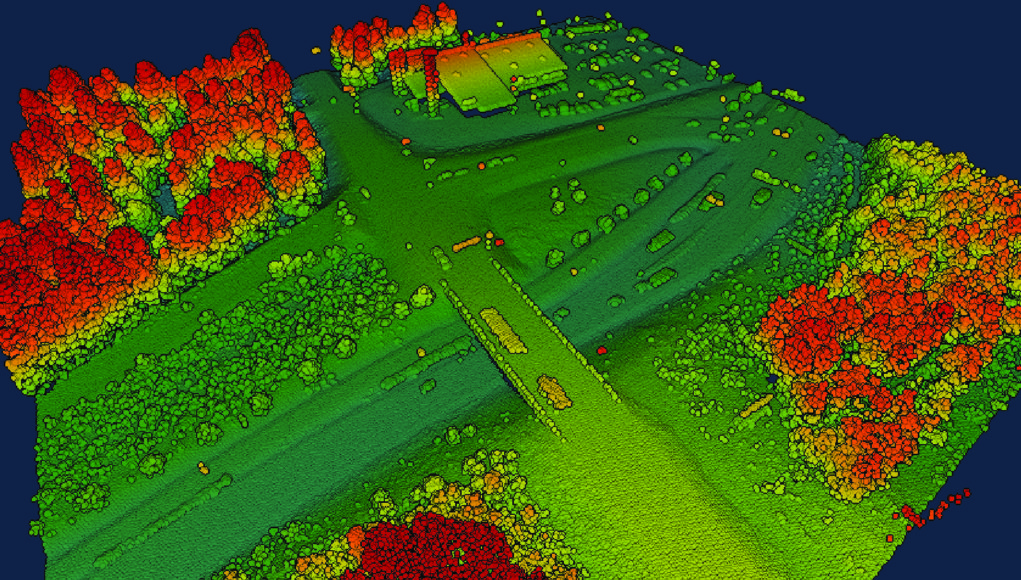
How do GIS mapping systems locate buildings that have never been surveyed and are not clearly visible form the all seeing eye in the sky? I was looking at my property on the latest upgrade of my counties gis site and see the outline of our 12x12 shed that has never shown up before. It's located directly under a huge beech tree that i'm guessing obscures it even when the foliage is off. Even has the angle in relation to my shop correct. We're well off the road and wooded. Just curious since I haven't found a clear explanation when reading up on it.
Thanks
I was looking at my property on the latest upgrade of my counties gis site and see the outline of our 12x12 shed that has never shown up before. It's located directly under a huge beech tree that i'm guessing obscures it even when the foliage is off. Even has the angle in relation to my shop correct. We're well off the road and wooded. Just curious since I haven't found a clear explanation when reading up on it.Thanks